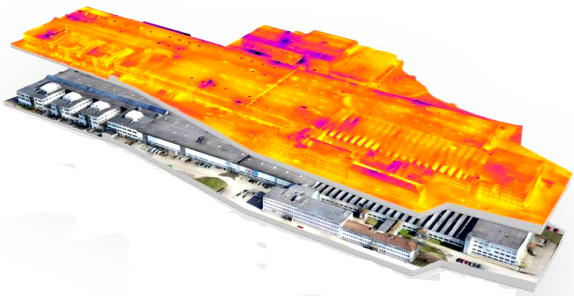
We are very proud to have signed a strategic agreement with NCC, Sweden’s third largest construction company. NCC have had drone operations within the company for the last 4 years, starting out with building their own UAV platform from scratch. Today they have 20 certified pilots within the organization that serve the projects with easy access to volumetric studies, traditional ortho photos, point clouds and 3D maps. The latest addition in their services is high resolution 3D models of buildings from Spotscale and the Spotplanner application for real estate projects.
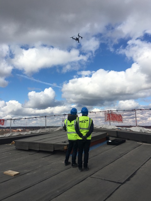
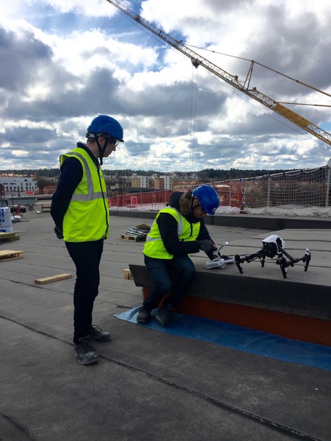
After a few hours of flying and processing on the Spotscale cloud, NCC’s UAV pilots can serve real estate developers with the data they need and an easy, visual tool for project meetings.
Architects and designers can use the 3D model on their format of choice. Spotplanner can then be used again to make the new 3D-design combined with the original 3D-model easy accessed for all stake holders over the web.
At Spotscale we strive to make the best 3D reconstruction service possible. With the Spotscale Cloud we’ll make our processing available to UAV operations around the world. We will keep refining the service with functionality of relevance to professionals in real estate development, real estate construction and real estate maintenance. And we want to be the go-to-choice for photogrammetry services and web tools when it comes to buildings in 3D.

 Explore in 3D